Hi, community
I created a map with administrative boundaries with QGIS.
Now I want to import this map to DHIS2. how to do that.
thank you
This is a similar question to one that was asked during the GIS Maps Academy by @souleymaneya1.
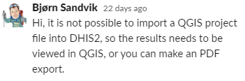
I would like to quote @Bjorn_Sandvik here:
Hi, it is not possible to import a QGIS project file into DHIS2, so the results needs to be viewed in QGIS, or you can make an PDF export.
Hi, @Gassim
Thank you for your quick response.
just for clarification: I converted my map’s chapfile file to a GML file in QGIS.
now; I have the GML file of my map, how to import it into DHIS2.
thank you
1 Like
Okay, I will leave @Bjorn_Sandvik to answer the question (or one of the experts); however, I would like to tell you that importing data back to DHIS2 was asked in the Maps GIS Workshop and there might be a second workshop to cover more of these types of questions.
I copied the link to this video to the time when this is mentioned (it’s in the end at 2:07:51):

1 Like
Hi @elmoujarrade, do your polygons (or points) correspond to orgunits that already exist in DHIS2? In that case, you just have to make sure the names match in GML: Home - DHIS2 Documentation (and that you have the right projection, EPSG:4326)
3 Likes
Hi, @Knut_Staring @Gassim
Here is an excerpt from my GML file. I opted to use the name of the region (Oriental). the error massage I received while importing is as follows:
Failed to validate job runtime - `GML import failed: Le type d'élément "gml:featureMember" doit se terminer par la balise de fin correspondante "</gml:featureMember>". On line 18 column 7.
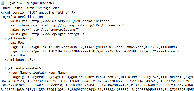
Hi, my XML is rusty, but you could try removing the backslashes in front of <ogr:Name> and </ogr:Name>
1 Like
1 Like
@Gassim
Thanks for sharing the tool “xmllint”
1 Like
You’re welcome! I never tried it but thought it could be helpful because I’ve seen DHIS2 experts here sometimes recommend use jsonlint.com … ![]()
Hi,Gassim
do you have a sample GML file with Organisations units to share with me.
Thank you for your support.
Hi @elmoujarrade, just to clarify, you can not import a “QGIS Project file” into DHIS2, but you can import a GML file that is properly formatted. We hope to switch to GeoJSON (a much cleaner format) in a future version: [DHIS2-7171] - Jira
Did you check the documentation on: Home - DHIS2 Documentation
Especially “Step 3 - Prepare the GML file” as you already have the GML file.
If it still does’t work, could you please share the full GML file with me?
1 Like
Try to use <ogr:uid>...</ogr:uid> when specifying the UID of your organisation units in the GML file.
3 Likes
Hi, Bjorn
I am very grateful for the support. I am so happy that the borders layer is displayed.
Thank you so much
1 Like