Overview of DHIS2 Maps on Friday 26 March at 11:00am CET
The webinar included exciting presentations of DHIS2 Maps features as well as the new features in the upcoming 2.36 release.
The recording is avalaible on DHIS2 YouTube channel
Overview of DHIS2 Maps on Friday 26 March at 11:00am CET
The webinar included exciting presentations of DHIS2 Maps features as well as the new features in the upcoming 2.36 release.
The recording is avalaible on DHIS2 YouTube channel
How make boundaries layer update based on your orgunit filter at the dashbord side
Is it possible to drill up into the maps?
Is it possible with Bubble Maps to show the value into the maps?
That elevation maps with malaria data that you show us at the begining, can you make a demo?
What would be your advice for countries with DHIS2 instance that already has very slow response when you try to upload large pivot-tables. They may face similar server resources issues when using this map. How can we overcome this?
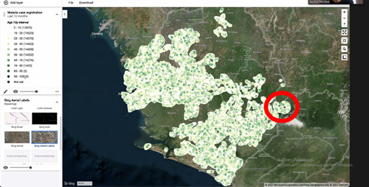
It seems like those data I have cercle are grouped. There is like a white line surrending events.
What is it please?
What is the difference between a polygone orgunit and a multipolygone orgunit?
Dear Bjorn, Austin, thank you! It was really helpful and interesting webinar. It would be great to have a link to the record of the webinar. )
Very nice walkthrough today. Thanks Bjorn & Austin. I love the doughnuts charts on the map. When will the 2.36 version be released?
Thanks for your feedback William - the current release date for DHIS2 2.36 is April 8.
Really thank you guys for the webinar. I’ve learned a lot and I’m quite interested now for the workshop.
The recording of today’s webinar is avalaible on DHIS2 YouTube channel.