Hi, Community
Let me share with you an anomaly that I encountered in DHIS2 map app.
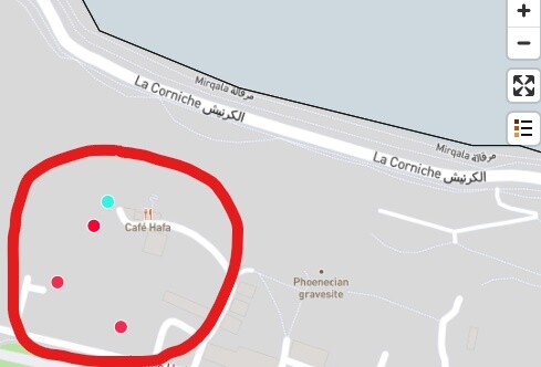
When I display the data of an event program on a map, when I use the zoom function the displayed data is not the same.
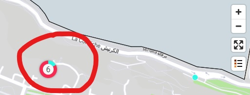
For example: the facilitys number is 4, when I zoom I find a total of 6 facilitys, so I don’t understand why this difference is.
Thank you in advance for your time.
@elmoujarrade actually just talked about this with a colleague. Any chance there aren’t two points with the same GPS that are just showing up on top of one another?
Hi, @Matthew_Boddie
I first thought that, but I have checked several times, there is only one GPS point for each event.
Moreover, I noted this anomaly at other locations.
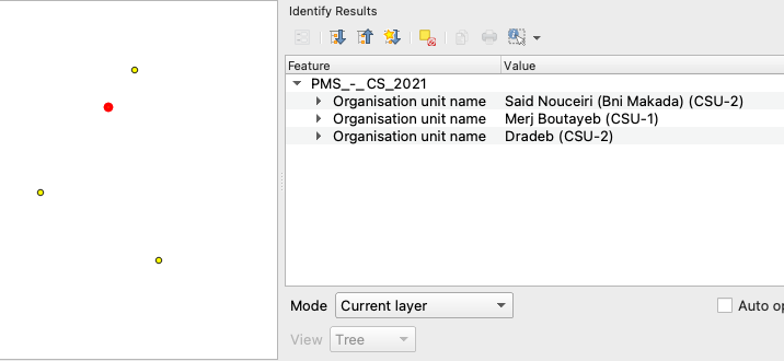
Hi, I have looked at the data behind the above map and the number (6) is correct. 3 events are placed on top of each other (they have the same coordinate):
Hi, @Bjorn_Sandvik
Thanks for explaining this case.
But, the overlay of the coordinates must not hide the label of each health facilities.
thank you for creating a JIRA issue for this.