AI Generated Summary
This document describes a project focused on Dengue Fever Prevention in Nepal, combining early warning and vulnerability assessment approaches. The project, initiated in 2024 by UiO HISP Centre, University of Oslo, SITAS ORI, and Planetary Health Research Centre, aims to address the surge of dengue cases in Nepal, a country highly vulnerable to climate change.
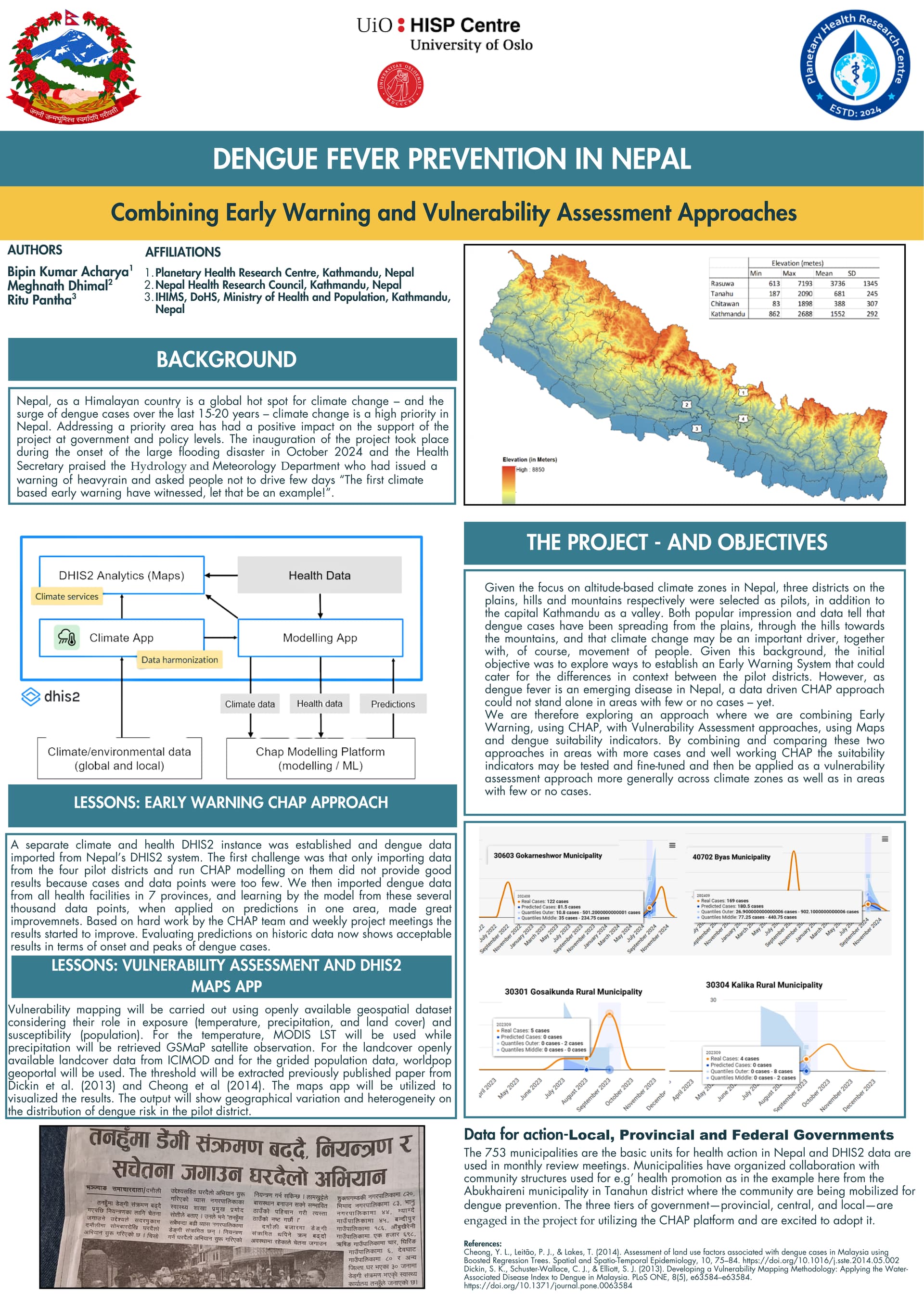
The project utilizes a Climate and Health DHIS2 (District Health Information Software 2) instance to import and analyze dengue data. Initially, data from four pilot districts (Rasuwa, Tanahu, Chitawan, and Kathmandu) were used, but due to insufficient data points, dengue data from all health facilities in seven provinces were imported, significantly improving prediction models.
The “Early Warning CHAP Approach” involves using climate and health data to predict dengue outbreaks, with a focus on altitude-based climate zones. The “Vulnerability Assessment” approach uses DHIS2 Maps and dengue suitability indicators, incorporating openly available geospatial datasets like MODIS LST (Land Surface Temperature) for temperature, GSMaP for precipitation, ICIMOD for land cover, and Worldpop geoportal for gridded population data.
The project highlights the importance of data for action at local, provincial, and federal government levels, with municipalities being the basic units for health action. Community mobilization for dengue prevention is also a key aspect, as exemplified by the Abukhaireni municipality in Tanahun district. The project aims to provide geographical variation and heterogeneity on the distribution of dengue risk in pilot districts. References to related research on land use factors and vulnerability mapping for dengue are also provided.