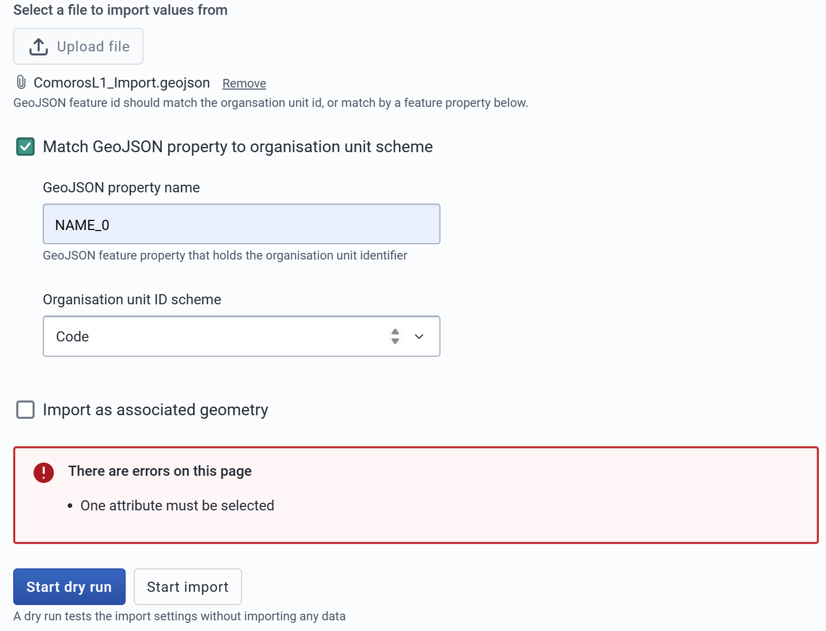
Hi, I’m trying to import the boundary my OU with the import app.
Not quite familiar with the process to be honest…here is my setup, and I cannot find any option like “catchment area” for the “Import as associated geometry”…
Not sure if there’s any error…Should I configure some GIS setup first?
I cannot start the dry run nor the import…
Hi @kateshih
The two options “match GeoJSON property” and the option to “import as associated geometry” are optional and you don’t need to select them
Hi @Gassim
Thanks for this tip (didn’t know they are optional)!
Yet…when I unticked them, the error still exists and prevents me from starting dry run ![]()
(I have tried my GeoJSON file on the Play instance and it worked…)
1 Like
Which version of play instance did you try? What is the complete version of the instance you are trying?
I tried the 2.39.2.1 Play and my instance is “2.39.3-SNAPSHOT” (using Ubuntu installation, not computer science background myself and trying to figure out release differences now ![]() )
)
However, I have again tried with:
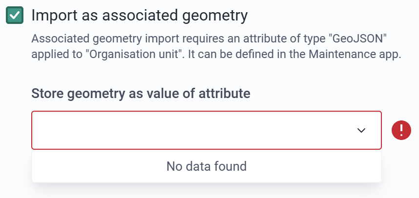
- creating an attribute e.g. boundary for OU with value type GeoJSON as instructed in the Imported app here
- ticked both of them
Fortunately, it worked!!! I found the attribute assigned here is needed for the map layer selection?
(Just happy to dig around the DHIS2 as a new DHIS2 user and getting familiar with everything…)
2 Likes
Thanks for sharing the info @kateshih!
Please revert back to the latest stable release as SNAPSHOT is not the stable release. Thanks!
1 Like
Got it! Will revert to a stable release!!!
Thanks so much!
1 Like
You’re welcome!
If you still face an issue in the stable release please share the steps to reproduce the issue so it’s possible to figure out what is causing the issue.
Please do update us on how it goes. Thanks!
Hi @Gassim,
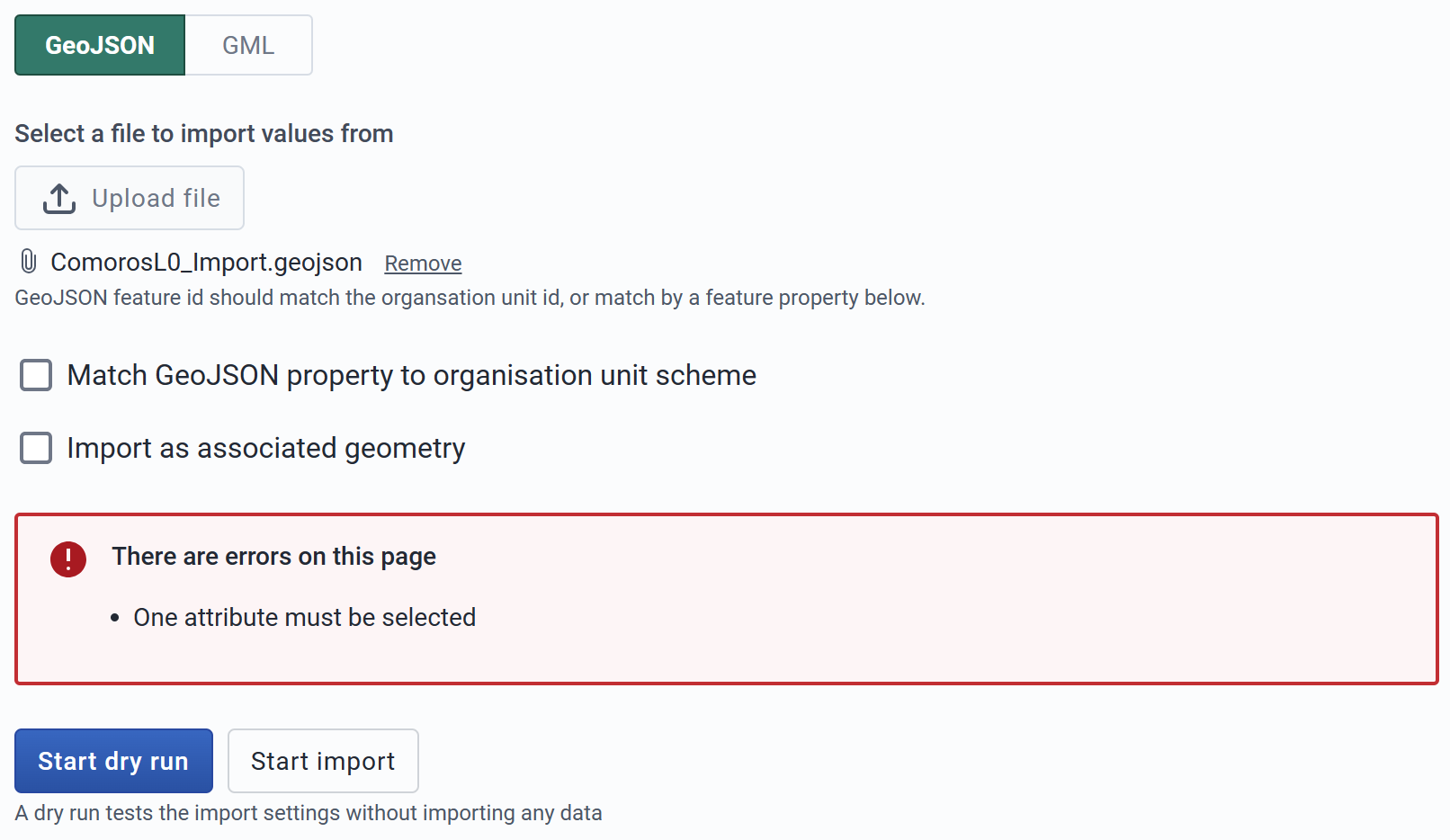
In the stable release environment, it works as you said! Both are optional! Thanks for tips!!!
1 Like
Hi @kateshih
I’m following on posts, I’m wondering which post here provided you with the solution. Would you mark the post as solved?
Thank you!
1 Like
This problem seems to be on the DHIS2 2.40
1 Like
Hi
Would appreciate if you could explain further where the issue is? The issue above seemed to have been solved, but if we can reproduce an issue in 2.40, then we can create a bug issue.
Thank you!
Interestingly I’m able to replicate the issue described above and that @stephocay is bringing up on a local instance running 40.3. That said, the same file and steps doesn’t produce the “one attribute must be selected” error on Play. Perhaps some kind of a cache issue of previous versions? Not sure. Still investigating.
Hi,
Actually, after updating to new stable releases later on, I also encountered the same issue. Yet, I just workaround with creating attributes of organization units.
Currently, I’m using 2.39.4.1.
Would be great to know the updates with this!
Hi,
I’ve done extensive testing, and isolated/identified the 2-3 bugs - see JIRA issue 17061 for details. Jennifer Arnesen from the analytics team will try to look into this later this week or early next week - I have given her a stripped-down instance that can be used for the testing.
In the short term, just note that the following works for GML import:
- Ensure your GML file is in the “old” GML v2 format - v 3.x don’t work.
- Import the file - it takes only 1-5 seconds, but the message that the file has been imported appear at once. Wait for the blackish popup at the bottom to disappear.
- Note that the newly imported layer is not accessible right away. The DHIS2 Browser Cache refresh will not help, you need to use the Chrome “Clear browsing data”, which will automatically log you out.
- Log in again, and pull up the imported layer in the Maps app to verify that the import worked.
Regards
Calle
1 Like
Sorry, forgot: Note that some GML formatting software might not explicitly give you the option to choose the format (it might automatically select e.g. the latest version 3.2 - which don’t work).
I’m using the latest QGIS, which provides 4 GML format options: 2.0, 3.0, 3.0degrees, and 3.2
Regards again
calle
1 Like