What is the procedure to follow to create the map of an organization unit in dhis2
Enter Latitude and Longitude:
You must have latitude and longitude values to create maps in the Maps app. Then your organisation units can be represented as points on a map, for example a health facility. Without this information, the Maps app will not work.
This setting is in the configuration of the OU, please read Create Organisation Unit
Thank you for your reply. I just put the latitude and longitude. But how to proceed to view the map.

1 Like
Thanks @Dan_Djari_Harouna!
That’s a good first step. You can read these docs for more information: Maps - DHIS2 Documentation
And you might be interested in watching this video from the Introduction to DHIS2 course: 4.1.1 Orientation to maps [Part 1 of 2] - YouTube
Well received. I will follow the steps and get back to you afterwards. THANKS
1 Like
@Gassim,
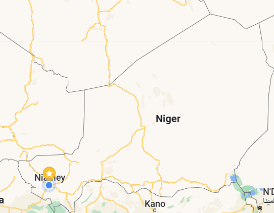
I have gone through all the suggested links. Everything went well until then. A problem that I can’t solve is the delimitation of a given area. I work on Niger which is divided into 8 regions. Each region is divided into departments. And each department is divided into communes. How should I delimit each given entity via a map?
1 Like
Great to hear!
Sorry, would you explain your question further please? And if you have an example (screenshot) of what you want to achieve it would be great. Thanks!
Import the gml file (polygons) for the regions.
Contact me @ raphaelkenyuri@gmail.com for assistance
1 Like
I work on Niger. Niger is made up of eight regions, I am interested in the two regions, Tahoua and Agadez. Each region is divided into departments and each department into communes. Our dhis2 composed of the following organizational units: Niger (Level 1), Tahoua (Level 2), Agadez (Level 2) and Each department (Level 3) and each commune (4)
1 Like
Thanks for the response. Then I think this depends on the coordinates you use.
@Gassim
Thank you for the answer. I would like to know the procedure to follow if I have the shape files of the areas considered
1 Like
Convert the shape files to gml using this site;
Make sure the org name match with the organization unit in the DHIS2.
1 Like